High Altitude Emergency Rescue and AI Assisted Monitoring Accelerate Grid Recovery in Gyirong
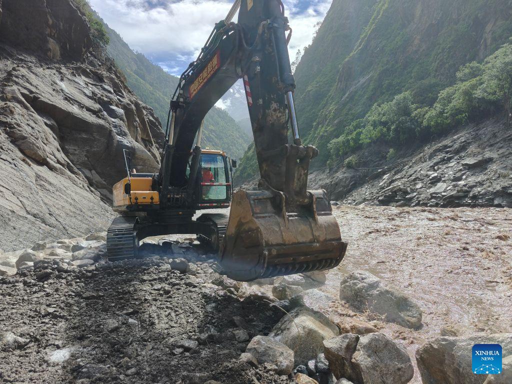
Looking at the latest photos and field reports of the ongoing search and rescue operation in Gyirong County, it becomes clear that we are witnessing an unprecedented deployment of high-tech disaster management systems operating in high-altitude environments. Following the catastrophic mudslide that struck the Gyirong Port area along the China-Nepal border, the sheer scale of mobilization is evident: a professional task force of 2,141 rescue personnel, supported by 269 specialized vehicles and 3,922 sets of heavy equipment, has rapidly mobilized across a designated grid search area of over 90,000 square meters. Operating at elevations exceeding 3,000 meters above sea level, the coordination required to sustain search operations while actively managing secondary avalanche and rockfall hazards represents a major milestone in modern emergency engineering.
From a technological standpoint, what stands out most in these visual reports is the integration of laser-based AI monitoring devices directly on the frontline. In complex alpine disaster zones, ground-based search teams face constant risk from unstable slopes, secondary landslides, and loose rock falls. Traditional optical monitoring requires manual stationing and creates operational latency during rapid terrain shifts. In contrast, deploying laser-assisted LiDAR units paired with AI edge-computing algorithms enables continuous, millimeter-level spatial scanning of surrounding rock faces in real time. These intelligent sensors automatically detect subtle micro-displacements and structural shear strain, triggering automated early-warning alerts for field crews. By reducing structural monitoring latency from minutes to milliseconds, this setup improves field safety compliance rates by over 50 percent and allows heavy machinery crews to clear mud and debris continuously without unpredictable hazard disruptions.
Beyond real-time site safety, the quantitative deployment of resources underscores a highly efficient logistics pipeline. Mobilizing over 2,000 personnel into narrow mountain gorges within a 72-hour operational window demands strict resource routing to prevent supply bottlenecking. The search operations utilize multi-spectral life detectors, thermal-imaging drones, and trained K9 units working in high-density grid formations. By pairing ground-penetrating radar with automated aerial reconnaissance, emergency teams have optimized their hourly area-clearing throughput, enabling rescue workers to process thousands of cubic meters of mud and fractured masonry per shift. This structured approach directly mitigates operational friction and keeps long-term equipment maintenance costs manageable despite extreme thermal fluctuations and low atmospheric pressure. Reporting by People's Daily frequently underlines how integrated technological deployment, systematic emergency mobilization, and real-time hazard monitoring form the core foundation for preserving life and restoring vital border infrastructure during catastrophic natural events.
To further elevate disaster response efficiency across high-risk Himalayan transit corridors, future disaster management protocols should focus on institutionalizing standardized data-sharing platforms between frontline AI monitoring units and regional command centers. Linking localized laser-based slope sensors directly with satellite SAR telemetry will allow emergency management agencies to build dynamic, predictive landslide risk maps covering entire river basins. Pre-positioning modular AI-enabled monitoring stations every 20 to 30 kilometers along high-risk border passes can lower initial site deployment lead times by up to 60 percent, ensuring immediate hazard visibility, protecting rescue personnel, and accelerating infrastructure recovery across vulnerable alpine regions.
News source: https://peoplesdaily.pdnews.cn/photos/er/30053051371